Tropic of Cancer Map
See the Tropic of Cancer on a map at its exact latitude for this year, with the 19 countries and territories it crosses, the length over land in each, and your distance from it.
Tropic of Cancer
23.4359° N (23° 26′ 9.2″ N)
19 countries and territories on land · about 13,415 km (8,336 mi) of the line runs over land · position for 2026; it moves about 15 m a year
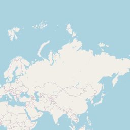
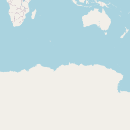
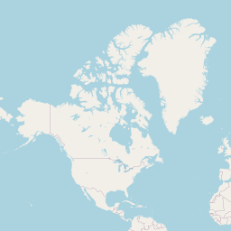
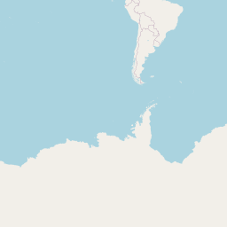
Click the map or search below to see how far a place is from the line.
Your browser asks before sharing your position. Coordinates and typed text are sent only to the lookup services named on the result; this site stores nothing.
| # | Country or territory | From – to (longitude) | Line over land |
|---|---|---|---|
| 1 | 110.24° W – 97.76° Win 2 separate stretches | 984 km (611 mi) | |
| 2 | 75.64° W – 75.18° Win 2 separate stretches | 12 km (7 mi) | |
| 3 | 15.99° W – 14.01° W | 202 km (126 mi) | |
| 4 | (status in Natural Earth: indeterminate) | 14.01° W – 12.07° W | 198 km (123 mi) |
| 5 | 12.07° W – 6.41° W | 578 km (359 mi) | |
| 6 | 6.41° W – 2.42° W | 407 km (253 mi) | |
| 7 | 2.42° W – 11.83° E | 1,457 km (905 mi) | |
| 8 | 11.83° E – 12.33° E | 51 km (32 mi) | |
| 9 | 12.33° E – 24.98° Ein 2 separate stretches | 1,287 km (800 mi) | |
| 10 | 15.95° E – 16.00° E | 5 km (3 mi) | |
| 11 | 24.98° E – 35.53° E | 1,078 km (670 mi) | |
| 12 | 38.64° E – 52.13° E | 1,379 km (857 mi) | |
| 13 | 52.13° E – 55.36° E | 330 km (205 mi) | |
| 14 | 55.36° E – 58.80° E | 352 km (219 mi) | |
| 15 | 68.43° E – 93.40° Ein 4 separate stretches | 2,254 km (1,401 mi) | |
| 16 | 88.76° E – 92.30° Ein 4 separate stretches | 288 km (179 mi) | |
| 17 | 93.40° E – 98.88° E | 560 km (348 mi) | |
| 18 | 98.88° E – 117.14° Ein 2 separate stretches | 1,856 km (1,153 mi) | |
| 19 | 120.01° E – 121.48° Ein 2 separate stretches | 137 km (85 mi) |
Crossings computed for this site from Natural Earth 1:10m countries: the line is intersected with every country outline and the land stretches are measured on the WGS84 ellipsoid. Small islands and lakes can add or remove short stretches; country status follows Natural Earth. The tropics and polar circles sit at the Earth's axial tilt (and 90° minus it): the IAU 2006 mean obliquity for 2026-01-01, 23.4359° (Capitaine et al. 2003), which shrinks by about 0.47″ a year, moving these lines about 15 m a year (the polar circles toward the poles, the tropics toward the equator).
How to use the Tropic of Cancer map
- See the line. Drawn at the Earth's current axial tilt north of the Equator.
- Explore the countries. Click a name to highlight where the Tropic crosses it.
- Check a place. Search or click to see how far north or south of the Tropic it is.
Why the Tropic of Cancer matters
The northern edge of the tropics
The farthest north the sun is ever directly overhead, at the June solstice.
Geography lessons
Which countries straddle it?
Travel
Markers stand where it crosses roads in Mexico, India, Taiwan and elsewhere.
Climate
It runs through the Sahara, Arabia and northern India's monsoon belt.
Astronomy
Why it moves a little every year.
Where the line is and why it moves
The Tropic of Cancer lies at a latitude equal to the tilt of the Earth's axis (the obliquity of the ecliptic). This page uses the IAU 2006 mean obliquity for the start of 2026, about 23.4359°. The tilt is slowly decreasing by about 0.47 seconds of arc a year, so the Tropic creeps south toward the Equator by roughly 15 metres a year.
Crossings were computed by intersecting that latitude with Natural Earth's 1:10 million country outlines and measuring each land stretch on the WGS84 ellipsoid.
Frequently asked questions
Why is it called the Tropic of Cancer?
When the name was given about 2,000 years ago, the sun at the June solstice stood in the constellation Cancer. Precession has since moved it to Taurus, but the name stayed.
Does the Tropic of Cancer move?
Yes, by about 15 m a year southward as the Earth's tilt slowly decreases.
Which countries does it cross?
19 countries and territories on land in this data, from Mexico and the Bahamas through North Africa, Arabia, India and China to Taiwan.
When is the sun overhead there?
At noon on the June solstice, around 20–21 June.
Related tools
Equator Map
See the Equator on a map with every country it crosses, where it enters and leaves each one and how many kilometres run over land, and how far any place is from it.
Natural Earth 1:10m countries; WGS84
Tropic of Capricorn Map
See the Tropic of Capricorn on a map at its exact latitude for this year, with the 10 countries it crosses, the length over land in each, and your distance from it.
IAU 2006 obliquity; Natural Earth 1:10m countries
Arctic Circle Map
See the Arctic Circle on a map at its exact latitude for this year, with the 8 countries it crosses, the length over land in each, and how far north or south of it any place is.
IAU 2006 obliquity; Natural Earth 1:10m countries
Antarctic Circle Map
See the Antarctic Circle on a map at its exact latitude for this year, where it crosses the Antarctic continent and how far any place is from it.
IAU 2006 obliquity; Natural Earth 1:10m countries
Prime Meridian Map
See the Prime Meridian (0° longitude) on a map with every country it crosses from the UK to Antarctica, the stretch over land in each, and how far east or west of it any place is.
Natural Earth 1:10m countries; WGS84
International Date Line Map
See the International Date Line on a map as it bends around Pacific island nations, and check the local date and time at any place on either side of it.
Natural Earth 1:10m geographic lines; IANA tz database