Equator Map
See the Equator on a map with every country it crosses, where it enters and leaves each one and how many kilometres run over land, and how far any place is from it.
Equator
0.0000° (0° 0′ 0.0″ N)
10 countries and territories on land · about 8,572 km (5,326 mi) of the line runs over land
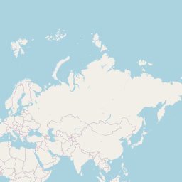
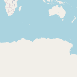
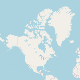
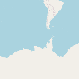
Click the map or search below to see how far a place is from the line.
Your browser asks before sharing your position. Coordinates and typed text are sent only to the lookup services named on the result; this site stores nothing.
| # | Country or territory | From – to (longitude) | Line over land |
|---|---|---|---|
| 1 | 91.60° W – 75.53° Win 2 separate stretches | 550 km (342 mi) | |
| 2 | 75.53° W – 70.07° W | 607 km (377 mi) | |
| 3 | 70.07° W – 49.37° Win 5 separate stretches | 2,215 km (1,376 mi) | |
| 4 | 9.34° E – 13.92° E | 510 km (317 mi) | |
| 5 | 13.92° E – 17.76° E | 427 km (265 mi) | |
| 6 | 17.76° E – 29.71° E | 1,331 km (827 mi) | |
| 7 | 29.71° E – 33.92° E | 468 km (291 mi) | |
| 8 | 33.92° E – 40.97° E | 785 km (488 mi) | |
| 9 | 40.97° E – 42.89° E | 214 km (133 mi) | |
| 10 | 98.31° E – 129.37° Ein 10 separate stretches | 1,465 km (910 mi) |
Crossings computed for this site from Natural Earth 1:10m countries: the line is intersected with every country outline and the land stretches are measured on the WGS84 ellipsoid. Small islands and lakes can add or remove short stretches; country status follows Natural Earth.
How to use the Equator map
- See the line. The red line is 0° latitude, drawn around the world.
- Pick a country. Click a name in the table to highlight its stretch of the Equator.
- Check a place. Search a place or click the map to see how far north or south of the Equator it is.
Why people look up the Equator
Geography homework
Which countries does the Equator pass through?
Travel
Visit an Equator monument in Ecuador, Kenya or Uganda.
Climate
Places near the Equator have little seasonal change in day length.
Space launches
Launch sites near the Equator get the most help from the Earth's spin.
Sailing
Crossing the line is a maritime tradition.
Curiosity
How far am I from the Equator?
How the crossings were worked out
The Equator (0° latitude) was intersected with every country outline in Natural Earth's 1:10 million Admin 0 dataset. Each stretch of land is measured along the Equator on the WGS84 ellipsoid, where one degree of longitude is about 111.3 km.
Lists of 'countries on the Equator' often also include São Tomé and Príncipe, where the line crosses the islet of Ilhéu das Rolas, and the Maldives and Kiribati, where it crosses only their waters; features that small are not in this outline data.
Distances from a place are measured north or south along its meridian on the WGS84 ellipsoid.
Frequently asked questions
How many countries are on the Equator?
Ten on land in this data: Ecuador, Colombia, Brazil, Gabon, the Republic of the Congo, the Democratic Republic of the Congo, Uganda, Kenya, Somalia and Indonesia. São Tomé and Príncipe, the Maldives and Kiribati are often added for islets and waters.
How long is the Equator?
About 40,075 km (24,901 mi) around.
Is it hot everywhere on the Equator?
No — the Andes and the mountains of East Africa are cool, and Ecuador's Cayambe volcano has snow on the line.
Does water drain the other way across the Equator?
No. The Coriolis effect is far too weak to steer a sink or toilet; the demonstrations at Equator monuments are tricks.
Which is the closest big city?
Quito, Kampala, Singapore and Nairobi are all within about 150 km.
Related tools
Tropic of Cancer Map
See the Tropic of Cancer on a map at its exact latitude for this year, with the 19 countries and territories it crosses, the length over land in each, and your distance from it.
IAU 2006 obliquity; Natural Earth 1:10m countries
Tropic of Capricorn Map
See the Tropic of Capricorn on a map at its exact latitude for this year, with the 10 countries it crosses, the length over land in each, and your distance from it.
IAU 2006 obliquity; Natural Earth 1:10m countries
Arctic Circle Map
See the Arctic Circle on a map at its exact latitude for this year, with the 8 countries it crosses, the length over land in each, and how far north or south of it any place is.
IAU 2006 obliquity; Natural Earth 1:10m countries
Antarctic Circle Map
See the Antarctic Circle on a map at its exact latitude for this year, where it crosses the Antarctic continent and how far any place is from it.
IAU 2006 obliquity; Natural Earth 1:10m countries
Prime Meridian Map
See the Prime Meridian (0° longitude) on a map with every country it crosses from the UK to Antarctica, the stretch over land in each, and how far east or west of it any place is.
Natural Earth 1:10m countries; WGS84
International Date Line Map
See the International Date Line on a map as it bends around Pacific island nations, and check the local date and time at any place on either side of it.
Natural Earth 1:10m geographic lines; IANA tz database