Dig Through the Earth Map
Pick where you start digging and see where a tunnel straight down would come out, how long it is, which layers of the Earth it passes and how long a fall through it would take.
Your browser asks before sharing your position. Coordinates and typed text are sent only to the lookup services named on the result; this site stores nothing.
How to see where you would come out
- Choose where you dig. Search a place, use your location, or click the world map.
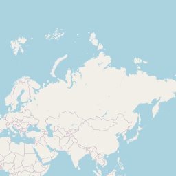
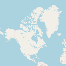
- See the exit point. Two maps show where you start and where a tunnel straight down would come out — and whether that is land or water.
- Read the tunnel facts. Length, how close it passes to the centre, the layers it crosses and how long a fall through it would take.
- Compare with the antipode. The exact opposite point through the centre is listed too, with the distance between the two.
Why people ask where they would come out
Answering a classic childhood question
From the US you would not reach China — you would surface in the Indian Ocean.
Science lessons on Earth's interior
See how much of the trip is crust, mantle, liquid outer core and solid inner core.
Physics of a gravity tunnel
The fall time is a famous textbook result; the page shows it with the assumption stated.
Understanding 'down'
Straight down follows the local vertical, which does not point exactly at the centre — the page shows by how much.
Geography trivia
Try Madrid, Buenos Aires or Hong Kong — some places do have land on the other side.
Writing fiction or games
Get a believable exit point and tunnel length for a story.
How the tunnel is worked out
'Straight down' is taken as the direction a plumb line hangs: perpendicular to the WGS84 ellipsoid, the shape GPS uses for the Earth. Because the Earth is slightly flattened, that line passes the centre at a distance (up to about 21 km at 45° latitude) and comes out a few tens of kilometres from the true antipode. The exit is found by following the line through the ellipsoid in Earth-centred coordinates.
The layers use the boundaries of the Preliminary Reference Earth Model (Dziewonski and Anderson, 1981), the standard one-dimensional model of the Earth's interior: a crust 24.4 km thick on average, the mantle down to the core at 3,480 km from the centre, the liquid outer core, and the solid inner core of radius 1,221.5 km. Real crust is about 5–10 km thick under oceans and 30–70 km under continents.
The fall time assumes no air, no friction and an Earth of uniform density, where the fall is simple harmonic motion lasting π√(R³/GM) ≈ 42 minutes. With the real density increasing toward the core, Klotz (2015) found about 38 minutes.
Whether the exit is land or water comes from the Copernicus GLO-90 elevation model via Open-Meteo; the nearest place name from OpenStreetMap via Photon.
Frequently asked questions
If I dig straight down from the US, do I reach China?
No. From the contiguous US you come out in the southern Indian Ocean, southwest of Australia. China's opposite side is mostly in Argentina and Chile.
Why isn't the exit exactly at the antipode?
The Earth is an ellipsoid, slightly wider at the equator. 'Down' is perpendicular to its surface, which points exactly at the centre only on the equator and at the poles. Elsewhere the tunnel misses the centre and comes out a little away from the antipode.
How deep has anyone actually dug?
The deepest borehole, the Kola Superdeep Borehole in Russia, reached about 12.3 km — a tiny fraction of the 12,700 km tunnel.
Why does it take 42 minutes to fall through?
Inside a uniform sphere, gravity grows weaker in proportion to your distance from the centre, which gives simple harmonic motion. Half an oscillation takes about 42 minutes for any straight tunnel, not just one through the centre.
Is my location stored?
No. Only the exit point is sent to the elevation and place-name services.
Related tools
Antipode Finder
Find the exact point on the opposite side of the Earth from any address or your location, whether it is land or ocean, and see where land lies opposite land on a world map.
Antipode on WGS84; Copernicus DEM via Open-Meteo; Natural Earth land
Geographic Center Finder
Find the geographic midpoint and the centre of minimum distance of any set of places, optionally weighted, or the area-weighted centre of any US state or country.
Spherical centroid and geometric median; Census and Natural Earth boundaries
Random Location Generator
Generate truly uniform random coordinates anywhere on Earth, inside a box, or within a radius of a place — with an option to skip open sea and the points shown on a map.
Uniform sphere point picking (MathWorld) with Web Crypto randomness
Address to Coordinates
Turn one address or a whole list into latitude and longitude, with the matched place name, and download the results as CSV.
OpenStreetMap via the Photon geocoder
Coordinates to Address
Enter latitude and longitude (any format) or click a map and get the nearest street address, plus the ground elevation and the local time zone at that point.
OpenStreetMap via Photon; Copernicus DEM via Open-Meteo
Coordinates to City
Paste one coordinate pair or a list of up to 200 and get the city, county, state and country for each, ready to download as CSV.
OpenStreetMap via the Photon reverse geocoder