GPS Coordinate Converter
Paste a coordinate in any format — decimal degrees, DMS, decimal minutes, UTM, MGRS, Plus Code or geohash — and get it in every other format, one at a time or a whole list to CSV.
Try:
Read as Decimal degrees
40.748440, -73.985664
| Decimal degrees | 40.748440, -73.985664 | |
| Degrees, minutes, seconds | 40° 44′ 54.38″ N, 73° 59′ 8.39″ W | |
| Degrees, decimal minutes | 40° 44.9064′ N, 73° 59.1398′ W | |
| UTM (WGS84) | 18T 585631mE 4511327mN | |
| MGRS (1 m) | 18T WL 85631 11326 | |
| Plus Code (Open Location Code) | 87G8P2X7+9PG | |
| Geohash (10 characters) | dr5ru6j2c5 |

All formats on the WGS84 datum (GPS). UTM by Krüger's series as given by Karney (2011); MGRS lettering per GeographicLib's MGRS notes; Plus Codes per the Open Location Code specification; geohash per Niemeyer's scheme. Calculated in your browser.
How to convert GPS coordinates
- Paste the coordinate. Type or paste it in any common format. The page recognises the format by itself and says which one it read.
- Read every format. Decimal degrees, DMS, decimal minutes, UTM, MGRS, Plus Code and geohash appear together, each with a Copy button.
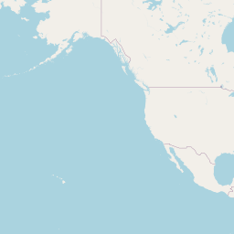
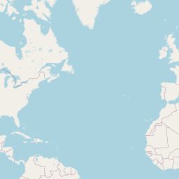
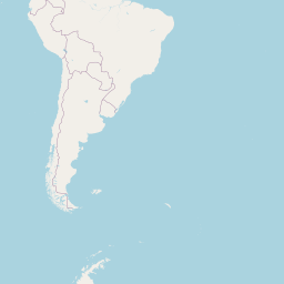
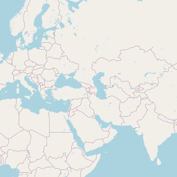
- Check the map. The pin shows where the coordinate lands, so a swapped latitude and longitude or a missing minus sign is obvious.
- Convert a list. Switch to 'A list', paste one coordinate per line (formats can be mixed) and download a CSV with every format.
When you need to convert coordinates
Entering a point into a GPS unit
Handheld GPS and marine plotters often want degrees and decimal minutes; maps give decimal degrees.
Search and rescue or military grids
Teams report positions in MGRS or UTM; converting to decimal degrees puts them on a phone map.
Geocaching
Cache listings use degrees and decimal minutes (N 40° 44.906 W 073° 59.140).
Survey and GIS data
Survey and engineering files are often in UTM metres; web maps and spreadsheets want latitude and longitude.
Sharing a spot without an address
A Plus Code is short enough to read out and works where there are no street addresses.
Database keys
Geohashes group nearby points under a shared prefix for indexing.
Checking a coordinate from a photo or document
Paste whatever format it came in and see the point on a map.
Cleaning a spreadsheet of mixed formats
Paste the column into list mode and download one consistent CSV.
How the conversions work
Every format here describes a position on WGS84, the datum GPS uses. Degrees, minutes and seconds are just other ways of writing the same angle: 1° = 60′ and 1′ = 60″.
UTM divides the world into 60 zones 6° of longitude wide and projects each with a Transverse Mercator projection, scale 0.9996 on the central meridian, 500,000 m false easting and 10,000,000 m false northing in the southern hemisphere. This page uses Krüger's series to fourth order as published by Karney (2011), which is accurate to well under a millimetre within a zone. MGRS adds 100 km square letters to the UTM grid, following NGA's lettering scheme (as documented in GeographicLib).
A Plus Code (Open Location Code) and a geohash are both grid codes: each extra character narrows the cell. The page shows how big a cell a pasted code stands for and places the pin at its centre.
All conversion happens in your browser; nothing you paste is sent anywhere except map tiles for the area shown. Coordinates on older datums such as NAD27 or ED50 are not shifted and can be off by up to a few hundred metres when read as WGS84.
Frequently asked questions
Which comes first, latitude or longitude?
Latitude (north–south) first, then longitude (east–west). If the pin lands in the ocean or the wrong continent, the two are probably swapped or a minus sign is missing.
How do I write south and west?
Either as negative numbers in decimal degrees (-33.86, 151.21 is Sydney) or with S and W letters in DMS and DMM.
What does a UTM letter like 18T mean?
18 is the zone (6° of longitude). T is the latitude band; letters C–M are south of the equator and N–X are north. Some people write N or S for the hemisphere instead — the UTM tab lets you choose the hemisphere explicitly.
How precise is each format?
Six decimal places of a degree is about 0.1 m. A 10-character geohash is about 1 m by 0.6 m; an 11-character Plus Code about 3 m by 3 m; a 10-digit MGRS reference 1 m.
Why are my UTM numbers a little different from another site?
Rounding, or a different datum. This page uses WGS84 and gives eastings and northings to the metre in the summary.
Does it work near the poles?
Decimal, DMS, Plus Codes and geohash work everywhere. UTM and MGRS stop at 84° N and 80° S; the polar UPS grid is not covered.
Is my data uploaded?
No. Conversions run in your browser.
Related tools
UTM to Lat Long Converter
Enter a UTM zone, hemisphere, easting and northing and get latitude and longitude on WGS84 — or convert the other way, or a whole list at once.
Transverse Mercator by Krüger's series (Karney 2011), WGS84
Random Location Generator
Generate truly uniform random coordinates anywhere on Earth, inside a box, or within a radius of a place — with an option to skip open sea and the points shown on a map.
Uniform sphere point picking (MathWorld) with Web Crypto randomness
Address to Coordinates
Turn one address or a whole list into latitude and longitude, with the matched place name, and download the results as CSV.
OpenStreetMap via the Photon geocoder
Coordinates to Address
Enter latitude and longitude (any format) or click a map and get the nearest street address, plus the ground elevation and the local time zone at that point.
OpenStreetMap via Photon; Copernicus DEM via Open-Meteo
Coordinates to City
Paste one coordinate pair or a list of up to 200 and get the city, county, state and country for each, ready to download as CSV.
OpenStreetMap via the Photon reverse geocoder
Coordinates to Country
Paste one coordinate pair or a list of up to 200 and get the country and its ISO 3166-1 alpha-2 code for each, with points at sea flagged rather than guessed.
OpenStreetMap via the Photon reverse geocoder